
Because of work, I have been travelling for the past two years. Visiting the company's offices across the country and taking part in migration or integration of data, upgrading desktops and connectivity, or even moving whole offices from one place to another. Usually there is not much time to sight-see. The trip usually has this (simplified) template :
- Thursday - Fly in, assess the site, inventory and verify old & new equipment.
- Friday - Sometimes organize local temp techs (or do myself) to remove old equipment, put in place new equipment, and work with the team I'm part of to build and bring up the new network.
- Saturday - Get network tweaked and new desktops configured to company standard with user profiles.
- Sunday - Work out issues and kinks on desktops, network or phone system. Collect old equipment for recycling and tidy up server room to company standards.
- Monday - Train local users on new desktop, answer questions, resolve or document issues to be resolved and then fly out.
 |
| I seem to take lots of airport "wing" photos |
It can get lots more involved, but those are the basics. All while still maintaining my day-to-day tasks. It can mean long days. Mostly I get to see airports, the inside of hotel rooms, office spaces and whatever place we are eating meals.
Occasionally though I get to a place where I can take a few hours on a Sunday afternoon to sight see. I usually don't get to plan on where until late Saturday.
This Work Trip was different.
If I planned it right - and weather and wildfire co-operated - I could get a FULL day in one of my Bucket list National Parks.When I saw I was headed to Fresno California, I noticed on the map that the town was near two places on my bucket list - Yosemite Valley and Kings Canyon National Park. Both were approximately two hours away from where I needed to be for work. Over dinner on another trip, I checked with my team lead if I could add a day or two on the front or back end of the Fresno trip. I got a preliminary OK, and after checking schedules, found it was easy to load two days to the front of the trip - I was travelling elsewhere right after Fresno.
It was too good an opportunity NOT to take. I booked early flights (actually saved the company money) and started planning.
As I planned and researched Yosemite was my front-runner. Hiking trails, waterfalls, rivers, vistas, and reading of John Muir's travels drew me in. The town of Oakhurst would serve as a great jumping off mid-point, being both an hour from the airport and Yosemite Valley. But recent wildfires had closed Route 41 - the main route - to everything I wanted to see in Yosemite.
I decided to go for it. Glad I did!
My air travel to Fresno had me switching planes in Phoenix. Not only did I need to switch gates, but terminals as well. In an airport I did not know. This was going to be fun! Thankfully they had some moving walkways between the terminals and I made it to my next flight with about 10 minutes till boarding call. Not bad, but I'm not one that enjoys calling it close.
Fresno airport's official name is Fresno Yosemite International Airport. Not all that bustling, it has two runways and one terminal, with a pretty long walk to my "Emerald Aisle" rental car. I wanted to do hiking, but not with ALL my equipment and bags!
 |
| You can walk thru a mock-up of a Sequoia Tree at the Fresno Airport |
Highway 41 in Fresno area is a multi-lane monstrosity like any other major city, but as you get out of Fresno and into the foothills, it becomes only two lanes. As I drove, past plateaus, ranches, and scrub filled fields, I noticed it was pretty dry - and plenty of smoke in the distant mountains.
 |
| Gray skies were actually smokey skies |
 |
| Entering into the Sierra foothills |
 |
| Town of Oakhurst - down in the valley |
 |
| Salmon Tacos - hit the spot for a hungry traveller! |
Items I brought from home for hikes included small flashlight, floppy hat, sweater, extra weatherproof jacket, binoculars and backsack.
I was pretty sure to see the most area possible that I would only be able to work in shorter hikes, so I found a great resource in Yosemite Hikes Website.
My Yosemite Day
Woke up before five am (not hard when your body is still on East Coast Time) showered, and grabbed by pre-packed gear. and headed out by 5:45, headed on Route 41 up into the Sierra National Forest. There were plenty of drivers headed up that knew the road better than I and rather then slow them down, I pulled over at a few overlooks to let them speed on past. As I climbed in elevation, it became more chilly, and as I was pulled over at an overlook, looked up. In the morning darkness there were more stars that I can usually see camping anywhere on the East Coast. Route 41 at this point was narrowing to two winding lanes, snaking up into the mountains - occasionally dipping into a valley and then climbing once again. When I got to the Park entrance, there was construction work going on, and no one manning the stone work booths to collect fees. As I neared my first goal, the first light let me see the drop-offs that were along the roadway. Maybe it WAS best I drove up in the dark!
I finally saw and passed through the long tunnel I was expecting - and pulled into the parking lot of Tunnel View. Only a few photographers and other early risers were there catching the first morning light as it hit the tops of El Capitan and Half Dome.
 |
| The Morning Light as it drops into Yosemite Valley |
The trail was rocky, steep, and not marked with blazes on trees or rocks as I'm use to on my East Coast hikes. I actually missed a turn and went off the trail a bit - though it rewarded with some great views from right over top the tunnel road.
 |
| Looking back where I just hiked - Yup I thought this was part of the trail. |
 |
| Interesting Lichens |
 |
| Through the trees, mountain views |
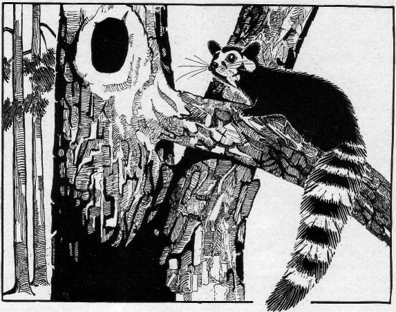 |
| California Ring-tailed Cat ~ Drawing by C. P. Russell |
By now at Tunnel View, at the parking lot was fuller, as cars trucks and RVs jockeyed for spaces. I jumped in the jeep and headed for my next spot - Bridal View Falls.
Bridal View Falls had plenty of parking, and the trail to the viewing area is fully paved. Since my visit was in autumn, the falls flow was not filled with spring snow melt, but it's height and surrounds were still impressive. It was interesting watching the updraft move the ribbon of falling water across the face of the cliff. After a short stay, and assisting some German visitors with a photo, I headed back down the trail to continue taking in the Yosemite Valley.
 |
| Yours truly at the end viewing point of Bridal Veil Falls |
I found two small granite rocks for mementos of my time there and placed them in my pocket. After exploring the meadow and creating a Photosphere of the meadow and surrounds, I jumped in the car again to explore further along Southside Road. Along the road, there are plenty of picnic areas or smaller pull-offs. One area had recently had a forest fire, evident by scorched and fallen trees. I turned into the small two spot parking area next to massive trees laying on their side. These were cut down it seemed after the fire damage.
 |
| A closeup of a felled pine |
 |
| Scorched Trees |
 |
| A hollow, burned out tree |
 |
| Scorch marks on a still standing tree |
 |
| A collection of the sights between fire area and Merced River |
This was only part of my memorable day in beautiful Yosemite Valley - which really stretched into the evening. Part two is here