Part 1 is
here - where my travels into Yosemite began.
After looking at the fire marked trees in the area I found between Southside Drive and the Merced River. I drove a little further and came upon a sign for a picnic area - with restroom. Seeing an opportunity to have a snack and use the facilities, I took the turnoff onto the gravel road. Only a few people were picnicking, as I drove along the roadway. I parked near where it began to circle back, near the pit toilets. After using the facility, I noticed a slightly overgrown sandy path into the woods, and decided to follow it. The sandy floor gave way to a pine needle covered path, shaded by deciduous and tall pine trees. Soon to my right the trees opened to reveal views of the river and mountains.
 |
| Path into the woods |
I jumped down the short embankment to a small beach. with a beautiful view of the river with the mountains right behind. The vistas made me just stop and gaze for quite some time. No one was around. I could hear some light traffic on Northside Drive, but could not see the road.
 |
| Looking out from the small beach to the North-east |
 |
| Looking out from the small beach to North-west. One of my favorite views in Yosemite Valley |
I hopped back up on the path and followed it a bit more along a turn in the river. Here the path leveled off with the river, and I was able to walk onto an open gravel larger beach on the curve of the Merced.
 |
| Gravel Beach along the Merced River |
After enjoying the views in solitude, I headed onto the trail, and back to the Jeep. After hydrating, I drove back onto Southside Drive. I followed it to signs directing toward Yosemite Village and tried to find parking near the Visitor Center. Due to construction in the lots and on the Northside road, I could not find parking until driving back toward Yosemite Lodge. This fortunately put me right across from the trail to Lower Yosemite Falls.
This area, either because of the later hour in the day, or proximity to Yosemite Visitors Center, had the most visitors I had seen on a trail so far. And calling this wide, macadam paved road a "trail" was a bit laughable. It did, however make access to view the Lower Falls easy for all that visited, even those in wheelchairs.
 |
| Lower Yosemite Falls |
 |
| Plenty of People visiting Lower Yosemite Falls |
Though I enjoyed the easy walk to the Lower Falls, the amount of tourists caused me not to stay very long. Rather than hike back the way I had come, I headed down a trail that went across the Yosemite Creek, and along the base of Yosemite Point Buttress. The water level was low in the creek, and the rock riverbed was dry, but still beautiful in its own way.
 |
| Dry, rocky bed of Yosemite Creek |
The trail rounded around a massive boulder then turned back down toward Northside Road. Along the way in a small meadow I came across a lone deer grazing close to the trail. It let me get close enough to snap a few photos.
 |
| A found friend on the trail |
Once back to Northside Road, I realized the trail I had taken had left me halfway between the Welcome Center and where I had parked. I decided to hike toward the Welcome Center to see what it had to offer. As I walked along I passed a young family. I remember as I passed the young ones hearing the parents discuss how they should have rented bikes to explore further along. It was nice hearing their interaction, and made me think of how great an experience having my own family with me would have been. After I had just passed the youngsters, I stepped on the edge of the macadam path. My ankle twisted, gave way - and down I fell!
 |
| Ripped my jeans too! |
I immediately got to my feet and assessed damage. My weakness has always been my ankles, and I've done this exact thing a few times before. I knew I needed to to keep walking on it (if not broken) so that it would keep loose. The rest of the day exploring depended on my ability to walk well. I continued walking, the ankle and knee hurt, but were staying mobile. Once at Yosemite Village, I went to a rest room and assessed the damages. The knee was pretty bloodied, and the ankle was sore and stiff, but not painful. Not too swollen either. I also picked some gravel out of my palm that helped break my fall. I sat on a bench, and re-adjusted my boots tighter. Pulling myself together, I was hurting a bit - but I could do this!
While inside at the Visitor Center, I began getting mad at myself while looking at the animal dioramas, historical, and geological exhibits. I KNEW that my ankles were susceptible to twists like this - since I was a kid. I should have been more careful! I got myself some water, and sat at a bench again and calmed myself down. Beating myself up would only deter my enjoyment of this awesome place. I decided to just take my time, look at the exhibits and museum. I was blessed to be able to what I have done already - and whatever I could still do - I'd make the most of it.
 |
| Writer and Environmentalist John Muir bronze statue |
 |
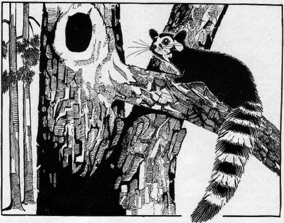
| Where I first learned about the Ring-tail. Glad I saw one in person! |
 |
| Would have loved to have encountered a Pika on a trail! Only saw this one in a Visitor Center Diorama |
 |
| Some History of the Yosemite Valley |
While in the Visitor Center, I also visited the bookstore/gift shop. Only thing I picked up was a Yosemite Patch for our collection. Tee-shirts and tourist trinkets just did not interest me.
Behind the Visitor Center, is a "Native American Village" to walk through. It displayed traditional Bark huts, tools and more of the Tribe that called Yosemite Valley home up to the late 1860s. The Miwok Tribe called Yosemite Valley, "Ahwahnee", which is believed to mean, "place of the gaping mouth". They referred to themselves as the "Ahwahneechee", "dwellers in Ahwahnee".
One thing I learned is that Black Oak Acorns were a staple in their diet. At times, the Black Oak Acorn made up to 60% of their food source!
Down a path from the Visitors Center is a small museum building, over 80 years old and was the first museum in a National Park. Exhibits included Ahwahee clothing, bead work, and tools. There were also some historical artifacts from when the park first opened. One unusual piece was a 1912 Indian motorcycle, possibly the first to visit the park.
While walking aback to the Jeep at Yosemite Lodge, I decided to stop for a snack at a small rest area with rest rooms. The bonus was a beautiful view to Yosemite Falls.
 |
| Snack time - Plum and Breakfast Bar |
Once back at the Jeep, I planned to explore further down Northside Road, but I made a wrong turn and ended up circling back on to Southside Road. Since I was now heading back toward Yosemite Village, I decided to get a late lunch. First I stopped at the Village Store to see what was available. Plenty of snacks and goods for campers, but I wanted more of a sandwich or burger. The Village Grill was right next door and fit the bill nicely.
After enjoying my burger and fries, I headed back onto Northside Road. Construction and traffic slowed things down, but at least the sights were interesting and beautiful. I didn't mind sitting in traffic with these surroundings! The construction appeared to be placement of new curbing and some drainage systems roadside being installed.
 |
| A Painter along the road |
 |
| Traffic and Construction - but with a view! |
Once past the Yosemite Lodge again, The traffic spread out. I still had plenty of time to explore, and I did not want to leave this breathtaking valley just yet. I found a small turn off with lot near the base of El Capitan, and since my ankle was holding up, decided to see if I could hike to it's base. I tried a few trails up, but some of the trails I tried either seemed to end, or became too overgrown to continue.
 |
| On a side trail - Over hang under a boulder that was big enough for a bear to take shelter - I imagined. |
 |
| On the trail - close, but never made it to the base |
 |
| There are climbers up there somewhere! |
 |
| Closer - but still not to the base |
As I hiked my ankle was starting to get tired. I could hear climbers of El Capitan shouting to one another, but did not find where they were. I was also not keen to bother them, and didn't want to be the "annoying tourist" invading on their prep or climb time. Also I felt slightly uncomfortable knowing climbers had just been killed by apartment size rock falls only the week before. I headed back down to the main trail to find my way back toward the Jeep. Along the main trail I ran into two climbers just starting the hike toward El Capitan's base - the time was now close to 5pm! They planned to make it half way up the face of the buttress, using headlamps as twillight and night came. They were covered with gear and seemed to be pretty relaxed and confident with what they were about to undertake.
 |
| Climbers laden with gear headed up the trail to the base of El Capitan |
 |
| Sign posted warning climbers and hikers of the recent large rockfalls |
I emerged from the side trail I had last used - trying to get to the base of El Capitan - a little further down the main trail. As I hiked back I came across an area of fallen trees that looked to be cut up to be processed for milling. Some that were still standing were twisted together - and rather interesting. I rested on a log here a bit and drank some water. I tried to keep hydrated as often as possible. Also in all the park this section (and the side trails nearing the base of El Capitan) were the only ones where I used insect repellent wipes. Small gnats or no-see-ums were buzzing about my head.
 |
| Interesting Twisted Tree |
Once back at the Jeep I realized where I was! I was on the exact opposite side of the large gravel beach I had enjoyed near the Picnic area earlier in the day! And that it seems to be called Cathedral Beach.
The long shadows as the day neared it's end were starting to come across the valley floor, so I drove back toward Tunnel View to watch the sun set. This was perhaps not the best choice, but still was enjoyable as I could feel the temperature dropping as the sunlight left the valley and mountains. Quite a few others had the same idea, to capture the waning light in the valley.
 |
| The Beauty of El Capitan, Half-Dome and more - once again. |
While resting on the rock wall, I sat back taking in both the scenery and people watching. I decided that it was still early, and I wanted to see - if possible - stars from Glacier Point. So I set my navigation and started driving. Elevation is: 4,400 feet at the Tunnel View and 7,200 feet at Glacier Point. quite the climb.
After exiting Tunnel View, the road was mostly downhill to the entrance of Glacier Point Road. I initially passed it, as it is on a curve, and more "driver friendly" coming from the opposite direction. I also encountered barreling around the curve toward me a large semi carrying construction equipment that caught me off guard. Fortunately I only had to drive up to the next pull off, and turn around.
The drive up to Glacier Point is quite curvy, with lots of drop-offs. As I was on a bit of straightaway a coyote was standing upon a hillside near the roadway. I slowed and stopped, but did not even think to grab a photo. He seemed as inquisitive of me as I of him! Further up the road I was greeted by temporary highway signs warning of smoke on the road, and sure enough around the next bend I could smell and feel the slight sting to my eyes of a fire burning on the hills below. Further along in the dimming sunlight I could see fire scarred trees right along the road. Smoke was in the air, but never impaired visibility to any extent.
Once I made it to Glacier Point there were many people coming back to the parking lot from the trails. Apparently I had missed a beautiful "second sunset" - due to the height of the surrounding mountain tops - by only a few minutes. Next time! The views in the twilight of Half Dome Village below were beautiful. Lights in the buildings were twinkling on the darkened valley below, and yet up on Glacier Point twilight still let me see everything surrounding me. Twilight did fall fast however, and there were just shadows to guide me back to the car - where I had left my flashlight. I decided to rest a bit in the car, and wait for about thirty minutes till the area was enveloped in total blackness. I was concerned that cloud cover might hamper my view, but these blew by quickly and I was rewarded with a crisp, cold, and stark clear sky, filled with an amazing star field, and a full harvest moon. I found a rock to sit upon, and spent some time just gazing up into the heavens. Looking again across to El Capitan, I could see the occasional twinkle of lights on the almost smooth buttress wall face, and thought of the climbers I had encountered earlier. That could be their headlamps as they still enjoyed the challenges of their planned evening rock climb!
 |
| A panoramic of the mountains beyond Glacier Point |
 |
| Can you see the Yosemite Waterfalls? |
 |
| Hard to get bearing in the darkness, but the lights of Half Dome Village Below Glacier Point |
By about 9pm it was quickly becoming cold, and for my attire, a little uncomfortably so. I retreated back to the car and with more than a little melancholy, decided it was time to leave back to my base camp in Oakhurst. As I backtracked down Glacier Point Road, I again saw a coyote. Not sure if the same one, but he was on the opposite side of the wildfire burning below. This time in the darkness I could see actual tree trunks glow with fire, and further down the mountain, a whole hillside flickered and glowed with fire. Smoke hung in the air.
The rest of my drive down Glacier Point road, and then back through the National Park gates (again unmanned) was without incident. Before returning to my room in Oakhurst, I picked up some balm for my ankle - to sleep more comfortably - and a ready-made sandwich that I devoured more quickly than I care to admit - apparently spending the day hiking, exploring into the evening, and the Pacific time change made me more hungry than I expected.
The knee - scabbed and healed - eventually. The ankle was better than expected coming out of the boot, although I hobbled a bit on it when tired for a week or so.
Many things will fade. Memories of my one day in Yosemite will be with me, I hope, forever.
 |
| My trusty, battered boots after Yosemite |


